Replay · AL162017
Nate: the story
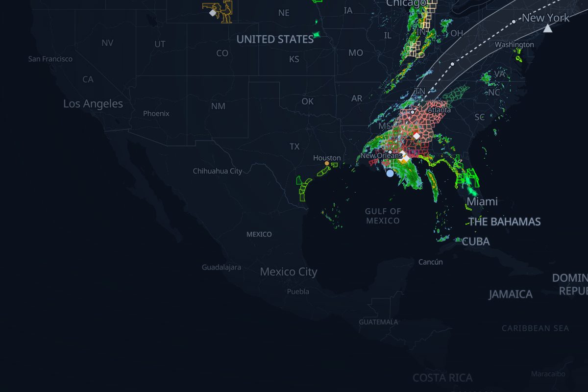
Oct 6, 12:20 UTC – Oct 9, 05:00 UTC · 33 NHC advisories. Radar, warnings, storm reports, ground stops and SEC filings, in order, with 117 links that show their evidence.
- 719 NWS warnings
- 558 storm reports
- 17 FAA airport programs
- 11 8-Ks naming Nate
- 117 rule-based links
- 389 radar frames, 10 min apart
Chapter 1: Approach
Oct 6–7
- The replay opens as the storm nears the US.Replay from here
Chapter 2: Landfall
Oct 7–8
- Nate makes landfall the mouth of the Mississippi River, Louisiana as a category 1 hurricane (75 kt, 983 mb).Replay from hereNHC Tropical Cyclone Report: Hurricane NateNHC best track (HURDAT2)
- Nate makes landfall near Biloxi, Mississippi as a category 1 hurricane (65 kt, 984 mb).Replay from hereNHC Tropical Cyclone Report: Hurricane NateNHC best track (HURDAT2)
Chapter 3: Inland
Oct 8–9
The replay window ends before the storm dissipates.
Chapter 4: Aftermath
Oct 9–Nov 14
- The replay window ends before the storm dissipates.Replay from here
- The aftermath: 10 8-Ks name Nate after the storm, the last on 2017-11-14.Replay from here
How we link records
| Rule | What it checks | Links |
|---|---|---|
| R4 solid | A storm report inside a warning polygon while it was in effect | 106 |
| R3 solid | An SEC 8-K that names the storm | 11 |
Solid lines mark rules that passed an independent check; dashed lines are context. Links are rule-based facts: each shows two records that overlap in place and time. How we know
Where this storm's data comes from
Every layer, the provider behind it and the period it covers.
| Layer | Provider | Period | Records |
|---|---|---|---|
| MRMS SeamlessHSR | NOAA/NSSL via Iowa Environmental Mesonet | Oct 6, 12:20 UTC – Oct 9, 05:00 UTC | 389 |
| NWS storm-based warning polygons | NOAA National Weather Service via Iowa Environmental Mesonet | Oct 6, 12:20 UTC – Oct 9, 05:00 UTC | 719 |
| NWS Local Storm Reports | NOAA National Weather Service via Iowa Environmental Mesonet | Oct 6, 12:20 UTC – Oct 9, 05:00 UTC | 558 |
| NHC advisories and best track | NOAA National Hurricane Center | Oct 6, 12:20 UTC – Oct 9, 05:00 UTC | 33 |
| FAA airport programs (ground stops and ground delay programs) | FAA Air Traffic Control System Command Center | Oct 6, 12:20 UTC – Oct 9, 05:00 UTC | 17 |
| SEC EDGAR 8-K filings | U.S. Securities and Exchange Commission | Oct 6, 12:20 UTC – Oct 9, 05:00 UTC | 11 |
- Radar: NOAA/NSSL MRMS SeamlessHSR, via the Iowa Environmental Mesonet (IEM), Iowa State University
- Warnings: NOAA/NWS, storm-based polygons via the Iowa Environmental Mesonet
- Storm reports: NOAA/NWS Local Storm Reports via the Iowa Environmental Mesonet
- Advisories and best track: NOAA/National Hurricane Center
- Airport programs: FAA Air Traffic Control System Command Center
- Filings: U.S. Securities and Exchange Commission EDGAR