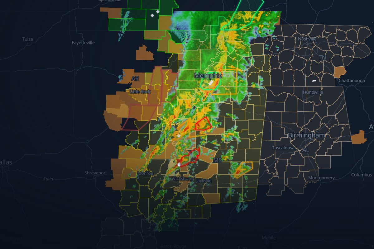
Replay · TO20230324
Rolling Fork tornado outbreak: the story
Mar 24, 22:00 UTC – Mar 25, 09:00 UTC. Radar, severe thunderstorm and tornado warnings, storm reports and ground stops, in order, with 139 links that show their evidence.
- 213 NWS warnings
- 194 storm reports
- 0 FAA airport programs
- 22 surveyed tornado tracks
- 139 rule-based links
- 56,844 customers out at the peak, in Tennessee
- 331 radar frames
Chapter 1: First warnings
Mar 24–25
- NWS Little Rock, AR issues the first Tornado Warning.Replay from here
- The largest hail reported: 1.75 in at Benoit, MS.Replay from here
Chapter 2: Rolling Fork
Mar 25
- The strongest tornado, an EF4, touches down: a 59 mi track.Replay from here
Chapter 3: Tennessee
Mar 25
- The strongest measured gust: 77 mph at 3 ESE Wears Valley, TN.Replay from here
- Peak outages: 56,844 customers out of power in Tennessee. The most in one county: Lauderdale County, AL, 26,166 out (53% of its customers) at 08:15 UTC.Replay from here
How we link records
| Rule | What it checks | Links |
|---|---|---|
| R4 solid | A storm report inside a warning polygon while it was in effect | 131 |
| R6 solid | A surveyed tornado track that began inside a Tornado Warning, with the warning's lead time | 8 |
Solid lines mark rules that passed an independent check; dashed lines are context. Links are rule-based facts: each shows two records that overlap in place and time. How we know
Where this storm's data comes from
Every layer, the provider behind it and the period it covers.
| Layer | Provider | Period | Records |
|---|---|---|---|
| MRMS SeamlessHSR | NOAA/NSSL via Iowa Environmental Mesonet | Mar 24, 22:00 UTC – Mar 25, 09:00 UTC | 331 |
| NWS storm-based warning polygons | NOAA National Weather Service via Iowa Environmental Mesonet | Mar 24, 22:00 UTC – Mar 25, 09:00 UTC | 213 |
| NWS Local Storm Reports | NOAA National Weather Service via Iowa Environmental Mesonet | Mar 24, 22:00 UTC – Mar 25, 09:00 UTC | 194 |
| ORNL EAGLE-I | Oak Ridge National Laboratory | Mar 24, 22:00 UTC – Mar 25, 09:00 UTC | 333 |
- Radar: NOAA/NSSL MRMS SeamlessHSR, via the Iowa Environmental Mesonet (IEM), Iowa State University
- Warnings: NOAA/NWS, storm-based polygons via the Iowa Environmental Mesonet
- Storm reports: NOAA/NWS Local Storm Reports via the Iowa Environmental Mesonet
- Airport programs: FAA Air Traffic Control System Command Center
- Tornado tracks: NOAA/NWS Damage Assessment Toolkit damage surveys
- Power outages: Oak Ridge National Laboratory, EAGLE-I (CC BY 4.0)
- County boundaries: U.S. Census Bureau