Replay · WS20260206
Winter Storm of February 6–8, 2026: the story
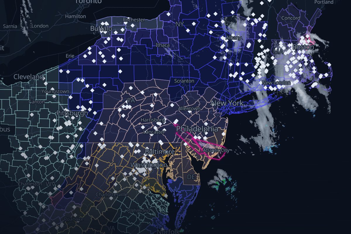
Feb 6, 09:00 UTC – Feb 8, 06:00 UTC. Radar showing snow and rain, winter warnings, storm reports and the surface low's track from the Weather Prediction Center, in order.
- 96 NWS warnings
- 1,415 storm reports
- 10 WPC surface-low analyses
- 8 FAA airport programs
- 4 rule-based links
- 271 radar frames, 10 min apart
Chapter 1: The setup
Feb 6–7
The replay opens with the first weather chart that shows it.
Chapter 2: The snow totals
Feb 7
- The largest snow report: 13 in at 2 SE Hamilton, MA.Replay from here
Chapter 3: The wind
Feb 7
- The strongest wind reported: 72 mph at 1 N Watersville, MD.Replay from here
Chapter 4: The bomb
Feb 8
- Bombogenesis: the low's pressure has fallen 26 mb in 24 hours, to 979 mb.Replay from here
- The low is at its deepest: 979 mb.Replay from here
How we link records
| Rule | What it checks | Links |
|---|---|---|
| R2 dashed | An airport program inside a warning that had been in effect for over 60 min (context) | 4 |
Solid lines mark rules that passed an independent check; dashed lines are context. Links are rule-based facts: each shows two records that overlap in place and time. How we know
Where this storm's data comes from
Every layer, the provider behind it and the period it covers.
| Layer | Provider | Period | Records |
|---|---|---|---|
| MRMS SeamlessHSR | NOAA/NSSL via Iowa Environmental Mesonet | Feb 6, 09:00 UTC – Feb 8, 06:00 UTC | 271 |
| NWS storm-based warning polygons | NOAA National Weather Service via Iowa Environmental Mesonet | Feb 6, 09:00 UTC – Feb 8, 06:00 UTC | 96 |
| NWS Local Storm Reports | NOAA National Weather Service via Iowa Environmental Mesonet | Feb 6, 09:00 UTC – Feb 8, 06:00 UTC | 1,415 |
| WPC coded surface bulletins | NOAA Weather Prediction Center via Iowa Environmental Mesonet | Feb 6, 09:00 UTC – Feb 8, 06:00 UTC | 10 |
| NOHRSC snowfall | NOAA National Operational Hydrologic Remote Sensing Center | Feb 6, 09:00 UTC – Feb 8, 06:00 UTC | |
| FAA airport programs (ground stops and ground delay programs) | FAA Air Traffic Control System Command Center | Feb 6, 09:00 UTC – Feb 8, 06:00 UTC | 8 |
- Radar: NOAA/NSSL MRMS SeamlessHSR, via the Iowa Environmental Mesonet (IEM), Iowa State University
- Warnings: NOAA/NWS, storm-based polygons via the Iowa Environmental Mesonet
- Storm reports: NOAA/NWS Local Storm Reports via the Iowa Environmental Mesonet
- Storm track: NOAA/NWS Weather Prediction Center coded surface bulletins, via the Iowa Environmental Mesonet
- Airport programs: FAA Air Traffic Control System Command Center
- Filings: U.S. Securities and Exchange Commission EDGAR
- Snowfall: NOAA/NWS National Operational Hydrologic Remote Sensing Center (NOHRSC)